
Great places to visit near The Lake House - Guidebook
Sightseeing & Cultural Tourism
Cultural and historical sights in the surrounding area.
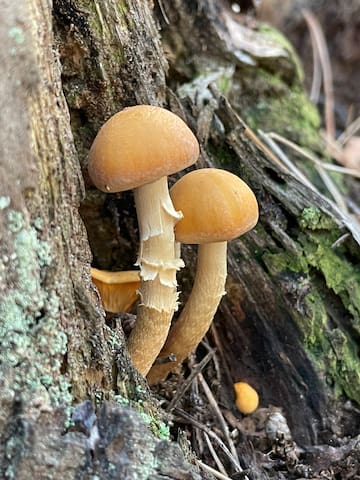
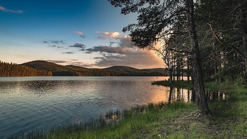
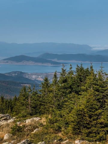
Mantaritza Biosphere Reserve, Bulgaria.
Ecological Characteristics
The reserve was initially established to protect the well preserved virgin coniferous forests and and localities of the Western capercaillie (Tetrao urogallus). Its territory ranges between 1200 and 1900 m a.s.l. The climate is transitional-continental (mountainous). The reserve comprises one major type of ecosystems – forests. Almost the whole area (99.6%) is covered by forests – mainly coniferous – of Picea abies, Pinus sylvestris and Abies alba but also some deciduous forests of Fagus sylvatica. Vascular plant diversity includes 124 species. The area is important for maintaining a population of Tetrao urogallus (Western capercaillie, Wood grouse) and other valuable fauna, e.g. 12 species of amphibians and reptiles, 52 bird species, 39 mammals, as well as a number of macromycete species of conservation concern. Socio-Economic Characteristics
Tourism in the reserve is very restricted, only hicking tourism along the marked tourist trail. No data for the number of visitors neither for the impact of tourism on local economy.
Mantaritza
Mantaritza Biosphere Reserve, Bulgaria.
Ecological Characteristics
The reserve was initially established to protect the well preserved virgin coniferous forests and and localities of the Western capercaillie (Tetrao urogallus). Its territory ranges between 1200 and 1900 m a.s.l. The climate is transitional-continental (mountainous). The reserve comprises one major type of ecosystems – forests. Almost the whole area (99.6%) is covered by forests – mainly coniferous – of Picea abies, Pinus sylvestris and Abies alba but also some deciduous forests of Fagus sylvatica. Vascular plant diversity includes 124 species. The area is important for maintaining a population of Tetrao urogallus (Western capercaillie, Wood grouse) and other valuable fauna, e.g. 12 species of amphibians and reptiles, 52 bird species, 39 mammals, as well as a number of macromycete species of conservation concern. Socio-Economic Characteristics
Tourism in the reserve is very restricted, only hicking tourism along the marked tourist trail. No data for the number of visitors neither for the impact of tourism on local economy.
This is the sixth largest dam in Bulgaria. It is situated very close to Batak (at 4 km) and not far away from Velingrad (at 19 km). On one of its shores is located the "Tsigov Chark" resort, and on the other the "Danoto" summer resort. The surroundings of the dam are very beautiful and suitable for walks. And a boat trip in the dam itself will give you the opportunity to explore more carefully the shores and to enjoy their beauty. You can also rent a water wheel or jet.
The place is suitable for fishing throughout the year.
The "Batak" dam offers a lot of amusements and beautiful views. We remind you only that swimming in it, as well as in "Dospat" dam is forbidden and dangerous.
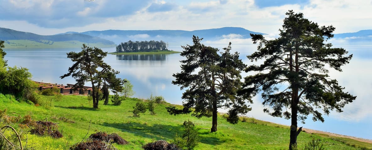
Batak Reservoir
This is the sixth largest dam in Bulgaria. It is situated very close to Batak (at 4 km) and not far away from Velingrad (at 19 km). On one of its shores is located the "Tsigov Chark" resort, and on the other the "Danoto" summer resort. The surroundings of the dam are very beautiful and suitable for walks. And a boat trip in the dam itself will give you the opportunity to explore more carefully the shores and to enjoy their beauty. You can also rent a water wheel or jet.
The place is suitable for fishing throughout the year.
The "Batak" dam offers a lot of amusements and beautiful views. We remind you only that swimming in it, as well as in "Dospat" dam is forbidden and dangerous.
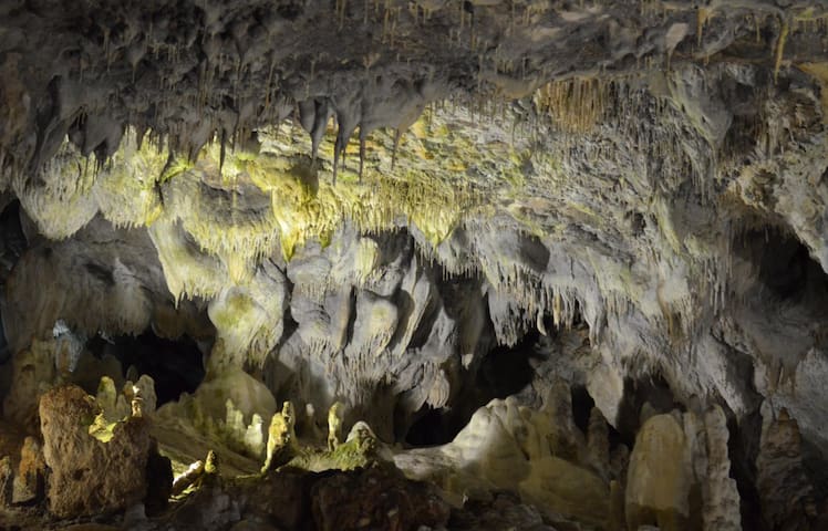
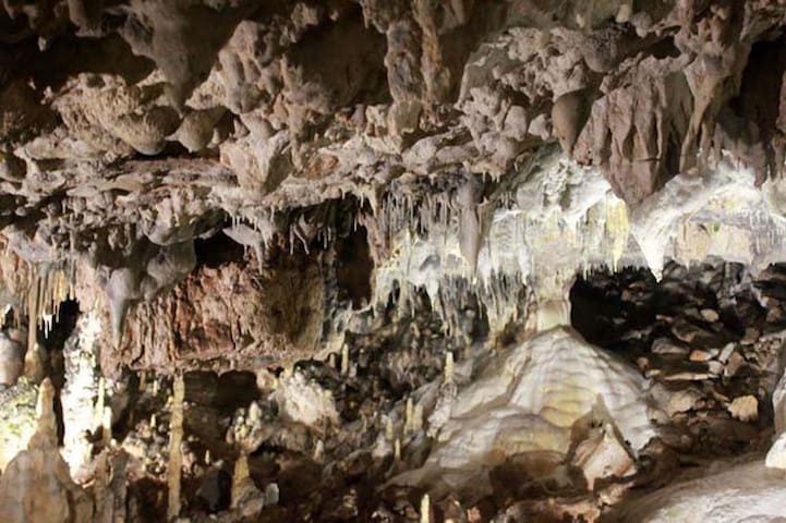
A beautiful place with its own magnetism. Snejanka (meaning: Snow White) is one of the most beautiful caves in Bulgaria. It is also known as the "Pearl of the Rhodope Mountains" and is included in the list of 100 national tourist sites. The cave is relatively small but extremely rich in natural cave decorations - stalactites, stalagmites, sinter lakes, and draperies.
The cave is open year-round but visiting hours vary, so it would be better to call first.
Contact +359 89 671 5972
كهف سنيجانكا
3 Дойранска епопеяA beautiful place with its own magnetism. Snejanka (meaning: Snow White) is one of the most beautiful caves in Bulgaria. It is also known as the "Pearl of the Rhodope Mountains" and is included in the list of 100 national tourist sites. The cave is relatively small but extremely rich in natural cave decorations - stalactites, stalagmites, sinter lakes, and draperies.
The cave is open year-round but visiting hours vary, so it would be better to call first.
Contact +359 89 671 5972
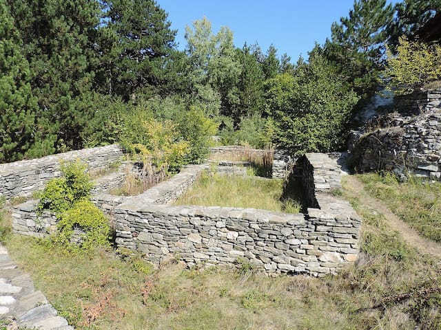
The Tsepina Fortress is situated a few kilometers north-west of the Rhodope village of Dorkovo. The fortress is one of the most often visited historical landmarks in this section of the Rhodope mountain. It is situated on a cone-shaped hill, 1,136 meters above the sea level.
Remains of a Thracian sanctuary, the foundations of a number of churches, water storages, a basilica, residential buildings, and a necropolis were found here during archaeological research. In its present look, the fortress was built between the 11th and the 13th century. The Russian scientist, specialist in Byzantine history, researched the fortress in as early as 1979 and found a unique marble relief of the apostles Peter and Paul. Presently, the valuable artifact is preserved in the Hermitage in Sankt Petersburg.
According to historical sources, this area was a residence of Despot Alexius Slav, a nephew of Tsar Kaloyan (reigned 1197 – 1207). He was a ruler of the Rhodope area in the 13th century, and during his time the mountain was called Slavievi Gori. A legend says that the Despot married Isabel, the daughter of the Latin Emperor Henrich. After the wedding, Alexius Slav took his wife in the fortress, and when she saw the high peaks and the dark forests, the exclaimed in French: “Oh, my God, my grave will probably be here!” The mother of Slav, Tamara, did not understand the words of her daughter-in-law, but she decided that this was a blessing and exclaimed in response: “Amen, let be it!” Soon after that the young woman got sick and died. She asked to be buried in the nearby peak, so that in the morning when the sun rises, her grave would be lit up. Soon after that Alexius Slav moved its residence in Melnik.
The Tsepina Hut is situated in close proximity to the fortress.
Contact +359878527379
Tsepina
ул.ЦепинаThe Tsepina Fortress is situated a few kilometers north-west of the Rhodope village of Dorkovo. The fortress is one of the most often visited historical landmarks in this section of the Rhodope mountain. It is situated on a cone-shaped hill, 1,136 meters above the sea level.
Remains of a Thracian sanctuary, the foundations of a number of churches, water storages, a basilica, residential buildings, and a necropolis were found here during archaeological research. In its present look, the fortress was built between the 11th and the 13th century. The Russian scientist, specialist in Byzantine history, researched the fortress in as early as 1979 and found a unique marble relief of the apostles Peter and Paul. Presently, the valuable artifact is preserved in the Hermitage in Sankt Petersburg.
According to historical sources, this area was a residence of Despot Alexius Slav, a nephew of Tsar Kaloyan (reigned 1197 – 1207). He was a ruler of the Rhodope area in the 13th century, and during his time the mountain was called Slavievi Gori. A legend says that the Despot married Isabel, the daughter of the Latin Emperor Henrich. After the wedding, Alexius Slav took his wife in the fortress, and when she saw the high peaks and the dark forests, the exclaimed in French: “Oh, my God, my grave will probably be here!” The mother of Slav, Tamara, did not understand the words of her daughter-in-law, but she decided that this was a blessing and exclaimed in response: “Amen, let be it!” Soon after that the young woman got sick and died. She asked to be buried in the nearby peak, so that in the morning when the sun rises, her grave would be lit up. Soon after that Alexius Slav moved its residence in Melnik.
The Tsepina Hut is situated in close proximity to the fortress.
Contact +359878527379
A little higher than Shiroka Polyana Dam is The Beglik Dam (1528 m above sea level), a component of the cascade Batak. Before the dam on the road to the town of Dospat is situated the secondary dam – Beglik. It is 22 km away from the town of Batak. Recently renovated asphalt road, the proximity to The Reserve Beglik, fish diversity, availability of hotel and restaurant, camping places, make dams in some of the most attractive and at the same time quiet places to relax over Batak. The black road is passable and going through a lot of protected areas (Samodivska Polyana, Goranov Chark, Chatama, Batlaboaz), in which the banned camping and fires except in designated areas. And not only that – the surroundings allows practising different hobbies – canoeing and boat trips, hiking, collecting herbs, fishing and hunting (in the permitted places).
Golyam Beglik
A little higher than Shiroka Polyana Dam is The Beglik Dam (1528 m above sea level), a component of the cascade Batak. Before the dam on the road to the town of Dospat is situated the secondary dam – Beglik. It is 22 km away from the town of Batak. Recently renovated asphalt road, the proximity to The Reserve Beglik, fish diversity, availability of hotel and restaurant, camping places, make dams in some of the most attractive and at the same time quiet places to relax over Batak. The black road is passable and going through a lot of protected areas (Samodivska Polyana, Goranov Chark, Chatama, Batlaboaz), in which the banned camping and fires except in designated areas. And not only that – the surroundings allows practising different hobbies – canoeing and boat trips, hiking, collecting herbs, fishing and hunting (in the permitted places).
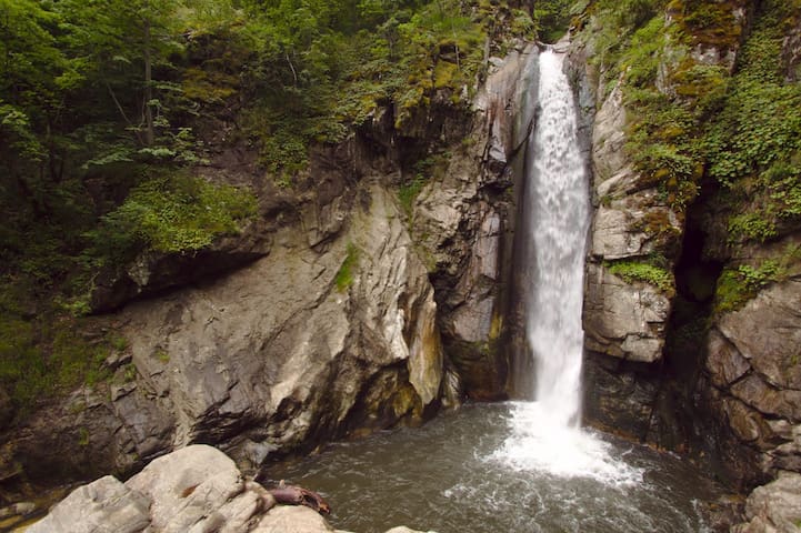
Fotinski Waterfalls is located in the western Rhodopes along the Fotinska River, 4.2 km from the village of Fotinovo. Located in altitude 880 meters above sea level.
The waterfall is a picturesque water cascade with a total height of about 30 m. It consists of three falls - the first is 6 - 7 m high, the second, which is the highest - 16 - 18 m, and the third - 5 - 6 m. At the base of the first drop is formed a pond with a diameter of about 5 - 6 m, and in the second - 4 - 5 m.
Fotinski Waterfalls
Fotinski Waterfalls is located in the western Rhodopes along the Fotinska River, 4.2 km from the village of Fotinovo. Located in altitude 880 meters above sea level.
The waterfall is a picturesque water cascade with a total height of about 30 m. It consists of three falls - the first is 6 - 7 m high, the second, which is the highest - 16 - 18 m, and the third - 5 - 6 m. At the base of the first drop is formed a pond with a diameter of about 5 - 6 m, and in the second - 4 - 5 m.
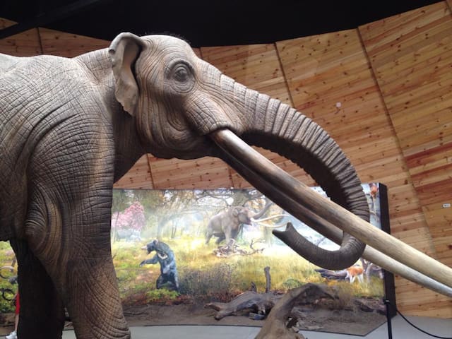
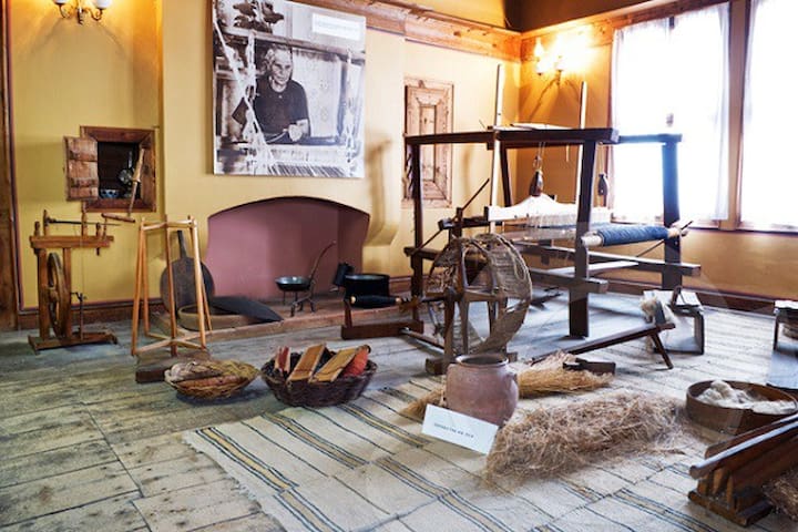
Dorkovo Museum in Dorkovo, Bulgaria, established in 2013 in a domed wooden structure, has a display of fossils collected from the Pliocene geological epoch of about five million years ago around the village of Dorkovo, a life-size model of a gomphothere, related to elephants, and a diorama.
Summer hours 09: 00-18: 00
(weekends: none)
Winter hours are 10: 00-19: 00
(weekends: none)
For more information caontact the museum.
Contact +359878527393
Dorkovo Museum
Dorkovo Museum in Dorkovo, Bulgaria, established in 2013 in a domed wooden structure, has a display of fossils collected from the Pliocene geological epoch of about five million years ago around the village of Dorkovo, a life-size model of a gomphothere, related to elephants, and a diorama.
Summer hours 09: 00-18: 00
(weekends: none)
Winter hours are 10: 00-19: 00
(weekends: none)
For more information caontact the museum.
Contact +359878527393
Lepenitsa Cave is located in the Western Rhodopes, at the summit of Sutkja (2186 m), 10 km southwest of the town of Rakitovo and 11 km south of Velingrad. It is 1525 m long and is located at 975 m above sea level, with a displacement of 10 m. The access to the cave is from Rakitovo and Velingrad.
Lepenica has three floors. The lower one has a length of 273 m and an underground river flows through it. On the second floor, in rainy weather, four lakes are formed, and in dry weather, the lakes are only two. The third floor is dry but inaccessible. The cave is rich in stalagmites, stalactites and is extremely beautiful. You will need a guide to visit this amazing sight.
Contact +359894494193 for more information.
cave Lepenitsa
22 ул. Никола ВапцаровLepenitsa Cave is located in the Western Rhodopes, at the summit of Sutkja (2186 m), 10 km southwest of the town of Rakitovo and 11 km south of Velingrad. It is 1525 m long and is located at 975 m above sea level, with a displacement of 10 m. The access to the cave is from Rakitovo and Velingrad.
Lepenica has three floors. The lower one has a length of 273 m and an underground river flows through it. On the second floor, in rainy weather, four lakes are formed, and in dry weather, the lakes are only two. The third floor is dry but inaccessible. The cave is rich in stalagmites, stalactites and is extremely beautiful. You will need a guide to visit this amazing sight.
Contact +359894494193 for more information.
The Clock Tower in Rakitovo was built in 1872 with donations from two local residents - Veli Haji Musa Efendi and his son - Hafiz Hussein Effendi. It was built on Brdo hill, close to the eastern part of the town.
The tower is made of wood and stone and has an octagonal shape with a conical roof, covered with sheet metal. Above the door there been a stone slab with an inscription in Arabic. The clock has two dials with Roman numerals.
The staircase of the tower was been replaced in 1960.
Clock Tower in Rakitovo is an architectural monument and a symbol of the city.
Clock Tower Rakitovo
61 ul. "Todor Tuparov"The Clock Tower in Rakitovo was built in 1872 with donations from two local residents - Veli Haji Musa Efendi and his son - Hafiz Hussein Effendi. It was built on Brdo hill, close to the eastern part of the town.
The tower is made of wood and stone and has an octagonal shape with a conical roof, covered with sheet metal. Above the door there been a stone slab with an inscription in Arabic. The clock has two dials with Roman numerals.
The staircase of the tower was been replaced in 1960.
Clock Tower in Rakitovo is an architectural monument and a symbol of the city.
Bekov rocks can be reached by a convenient road from the village of Ravnogor, which is located at 1340 m above sea level. Its land has been inhabited since the time of the Thracians, as evidenced by the many Thracian mounds around the village. Bekovi skali reveals a view of the hills of the Western Rhodopes, covered with centuries-old forests and among them the sparkling waters of Vacha Dam. On the rocks are placed benches for tourists to rest.
Bekov Rocks Panorama
Bekov rocks can be reached by a convenient road from the village of Ravnogor, which is located at 1340 m above sea level. Its land has been inhabited since the time of the Thracians, as evidenced by the many Thracian mounds around the village. Bekovi skali reveals a view of the hills of the Western Rhodopes, covered with centuries-old forests and among them the sparkling waters of Vacha Dam. On the rocks are placed benches for tourists to rest.
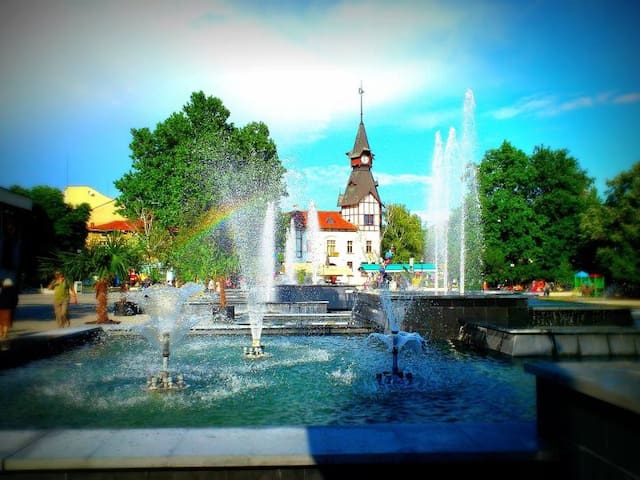
Among the most remarkable, romantic and mysterious places of Velingrad is the Kleptuza spring. The park with its two lakes is one of the symbols of the town. It is located in the Chepino district, one of the three thermal zones in Velingrad. Much of the spring water is used for drinking; the other part fills two beautiful lakes, which then flow into the Chepinska River, and from it into the Maritsa and the Aegean Sea.
8 سكان محليون يوصون بهذا
بحيرة كليبتوزا
118 ul. "Nikola Vaptsarov"Among the most remarkable, romantic and mysterious places of Velingrad is the Kleptuza spring. The park with its two lakes is one of the symbols of the town. It is located in the Chepino district, one of the three thermal zones in Velingrad. Much of the spring water is used for drinking; the other part fills two beautiful lakes, which then flow into the Chepinska River, and from it into the Maritsa and the Aegean Sea.
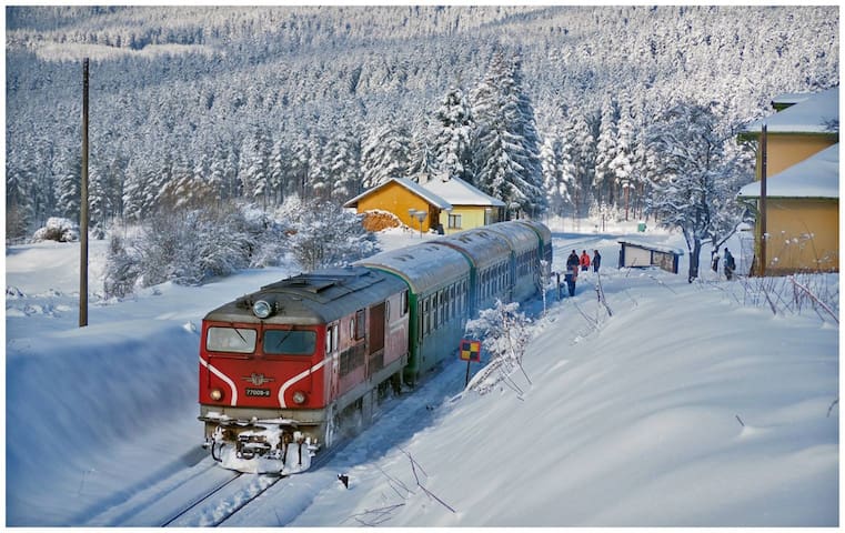
The Rhodope Narrow Gauge in Bulgaria Ranked among The Guardian Top 10 Best Scenic Rail Journeys in Europe
The Septemvri-Dobrinishte railway ranked among the top ten of the best scenic rail journeys in Europe by the prestigious British newspaper The Guardian.
Narrow gauge in Bulgaria
"Time moves slow on the Septemvri-Dobrinishte railway in south-west Bulgaria (150km south of Sofia). Two weeks into a fairly austere trip in the Balkans, we found ourselves whisked away by the slow, narrow-gauge train that connects the Upper Thracian Plain with the Rhodopes, Rila and Pirin mountains, winding its way through narrow gorges and idyllic river valleys for five hours. The line features suited station-masters ushering families into the spartan carriage: it was a rare treat to stand in the open-air passages between them. We stopped for the night in the spas of Velingrad (2½ hours from Septemvri), imagining ourselves as extras in a Wes Anderson rip-off, before continuing on to Razlog."
Тhe narrow-gauge line passes through the highest railway station in the Balkans 1267,4m
(Avramovo railway station)
• Tickets (€9) bought at stations, not available online.
Septemvri
The Rhodope Narrow Gauge in Bulgaria Ranked among The Guardian Top 10 Best Scenic Rail Journeys in Europe
The Septemvri-Dobrinishte railway ranked among the top ten of the best scenic rail journeys in Europe by the prestigious British newspaper The Guardian.
Narrow gauge in Bulgaria
"Time moves slow on the Septemvri-Dobrinishte railway in south-west Bulgaria (150km south of Sofia). Two weeks into a fairly austere trip in the Balkans, we found ourselves whisked away by the slow, narrow-gauge train that connects the Upper Thracian Plain with the Rhodopes, Rila and Pirin mountains, winding its way through narrow gorges and idyllic river valleys for five hours. The line features suited station-masters ushering families into the spartan carriage: it was a rare treat to stand in the open-air passages between them. We stopped for the night in the spas of Velingrad (2½ hours from Septemvri), imagining ourselves as extras in a Wes Anderson rip-off, before continuing on to Razlog."
Тhe narrow-gauge line passes through the highest railway station in the Balkans 1267,4m
(Avramovo railway station)
• Tickets (€9) bought at stations, not available online.
The Ethnographic Museum is at the Balinova House. The house is one of the survivors of the town in 1876. It is located in the town of Batak.
Address: ul. "Antonivanovtsi" 123, 4580 Batak
Балинова Къща
123 ulitsa "Antonivanovtsi"The Ethnographic Museum is at the Balinova House. The house is one of the survivors of the town in 1876. It is located in the town of Batak.
Address: ul. "Antonivanovtsi" 123, 4580 Batak
With a height of 2081.9 meters, it is the sixth highest peak in the Rhodope Mountains and the second highest, after Golyama Syutkya peak 2185 meters from the Batashka Mountain section.
Batashki Snezhnik is the highest peak in the municipality of Batak, as well as the largest protected area in the municipality (1054 ha).
Баташки Снежник
With a height of 2081.9 meters, it is the sixth highest peak in the Rhodope Mountains and the second highest, after Golyama Syutkya peak 2185 meters from the Batashka Mountain section.
Batashki Snezhnik is the highest peak in the municipality of Batak, as well as the largest protected area in the municipality (1054 ha).
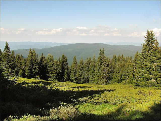
Golyama Syutkya or Golyama Syutka (from June 29, 1942 to January 5, 1946 Golyam Voden) with a height of 2186 m, is the third highest peak in the Rhodopes and the highest peak in the Batashka mountain range. It is a rounded peak with sloping slopes, located in the middle of the massif. Geomorphologically, it is a remnant of an older relief, built mainly of granite and gneiss, with brown forest soils predominating. The peak itself is densely overgrown with coniferous forests, among which there are extensive pastures. At its foot are the valleys of rivers of local importance, and among the largest are Lepenitsa, Ribna Reka, Cherno Dere, Batalach and others. At the foot of the peak is the cave Lepenitsa. The fauna is typical for this part of the Rhodopes and extremely rich, as here is the highest deer gathering in Bulgaria.
Голяма Сюткя
Golyama Syutkya or Golyama Syutka (from June 29, 1942 to January 5, 1946 Golyam Voden) with a height of 2186 m, is the third highest peak in the Rhodopes and the highest peak in the Batashka mountain range. It is a rounded peak with sloping slopes, located in the middle of the massif. Geomorphologically, it is a remnant of an older relief, built mainly of granite and gneiss, with brown forest soils predominating. The peak itself is densely overgrown with coniferous forests, among which there are extensive pastures. At its foot are the valleys of rivers of local importance, and among the largest are Lepenitsa, Ribna Reka, Cherno Dere, Batalach and others. At the foot of the peak is the cave Lepenitsa. The fauna is typical for this part of the Rhodopes and extremely rich, as here is the highest deer gathering in Bulgaria.
Neighborhoods
Here you will find information for the towns around and what to see in them.
Things to see in Batak:
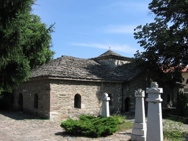
The "Sveta Nedelya" church in Batak is a pantheon of the Bulgarian sacrifice for freedom. It has become a symbol of the struggles for national freedom and has a huge historical mission: to educate Bulgarian national self-consciousness and national spirit.
Another landmark in the town is the church "Sveta Bogoridica" - one of the biggest temples in the Pazardzhik region. Its iconostasis is over 10 m long and 6 wide.
8 سكان محليون يوصون بهذا
Batak
Things to see in Batak:
The "Sveta Nedelya" church in Batak is a pantheon of the Bulgarian sacrifice for freedom. It has become a symbol of the struggles for national freedom and has a huge historical mission: to educate Bulgarian national self-consciousness and national spirit.
Another landmark in the town is the church "Sveta Bogoridica" - one of the biggest temples in the Pazardzhik region. Its iconostasis is over 10 m long and 6 wide.
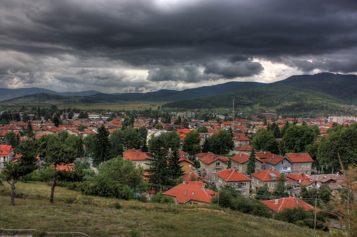
The town of Velingrad is one of the most beautiful and most famous among the Bulgarian Balneological resorts. It lies at the western end of Chepino Valley, one of the most attractive parts of the Rhodopean Mountains in Southern Central Bulgaria. There are 70 sources of mineral water with curative and preventive properties.
The numerous archaeological findings, such as stone and bone tools, bronze artifacts and others imply the existence of life since ancient times in these places.
11 سكان محليون يوصون بهذا
Velingrad
The town of Velingrad is one of the most beautiful and most famous among the Bulgarian Balneological resorts. It lies at the western end of Chepino Valley, one of the most attractive parts of the Rhodopean Mountains in Southern Central Bulgaria. There are 70 sources of mineral water with curative and preventive properties.
The numerous archaeological findings, such as stone and bone tools, bronze artifacts and others imply the existence of life since ancient times in these places.
In the village of Fotinovo, the time has stopped - cobblestone paths of round stones and numerous ancient bridges on black mountain roads surrounding the area. Near the village is the stone vaulted bridge "Kemera". It is 30 meters long and 6 meters high. It is built without any mortar in the foundations, and the arc is supported by only a few semi-worked quarters of stones. The historians claim that Alexander the Great passed across on the way to the Thracian sanctuary of Dionysus in Genevra.
4.2 km from Fotinovo Village you can see the Fotinovo Waterfalls during Spring, Summer and Autumn seasons.
Near the village of Nova mahala are the remains of the monastery complex "Church of Ridge".
The remnants of the Thracian rock sanctuary in the place of Genevra are also preserved there. The remains of the sanctuary are at a mountain peak of 1700 m height. Inside it are two cult rooms for pagan rites.
Fotinovo
In the village of Fotinovo, the time has stopped - cobblestone paths of round stones and numerous ancient bridges on black mountain roads surrounding the area. Near the village is the stone vaulted bridge "Kemera". It is 30 meters long and 6 meters high. It is built without any mortar in the foundations, and the arc is supported by only a few semi-worked quarters of stones. The historians claim that Alexander the Great passed across on the way to the Thracian sanctuary of Dionysus in Genevra.
4.2 km from Fotinovo Village you can see the Fotinovo Waterfalls during Spring, Summer and Autumn seasons.
Near the village of Nova mahala are the remains of the monastery complex "Church of Ridge".
The remnants of the Thracian rock sanctuary in the place of Genevra are also preserved there. The remains of the sanctuary are at a mountain peak of 1700 m height. Inside it are two cult rooms for pagan rites.
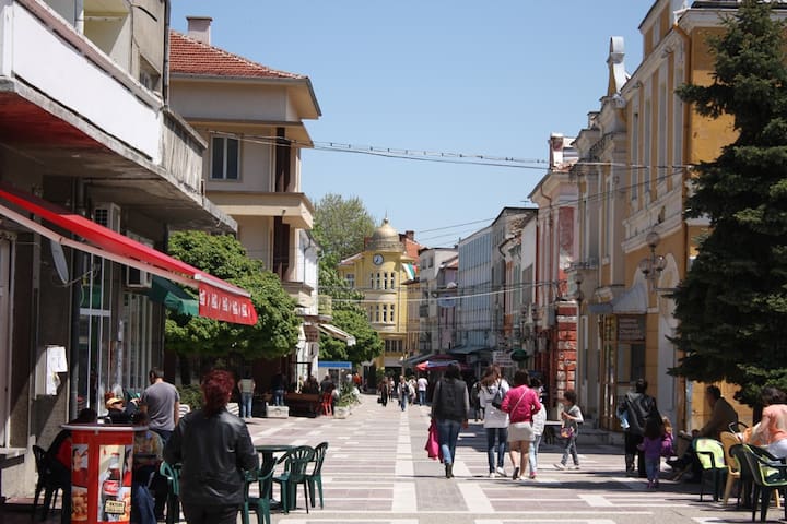
Pazardzhik was founded by Tatars from what is today Bilhorod-Dnistrovskyi in 1485 on the left bank of the river Maritsa, near the market of the region, an important crossroad at the middle of this productive region, and named Tatar Pazardzhik meaning "small Tatar market". Thanks to this favourable location, the settlement quickly developed. While it was very small at the beginning of the 19th century, it became the administrative centre for the region at the end of the century and remained so until the dissolution of the Ottoman Empire.
The old clock tower is one of the landmarks of Pazardzhik.
During the following centuries, the town continued to grow and strengthened its position. Trade-in iron, leather and rice prospered. The town impressed visitors with its beautiful houses and clean streets. In 1718 Gerard Kornelius Drish visited Pazardzhik and wrote: "the buildings here according to construction, size and beauty stand higher than those of Niš, Sofia and all other places".
During the Ottoman period Pazardchik had 18 mosques but only Kurshumlu Mosque, built-in 1667 survived till today.
The Russians under Count Nikolay Kamensky took the city after a brief siege in 1810. By the mid-19th century, Pazardzhik was a big, important centre of crafts and trade, with a population of about 25,000 people. It hosted two big annual fairs, and a big market Tuesdays and Wednesdays. There was a post office with a telegraph.
In 1837 the Church of the Mother of God was built – an important national monument, famous for its architecture and woodcarving. In the mid-19th century, Pazardzhik became an important cultural centre: a school was opened in 1847, a girls' school in 1848, a community centre in 1868, the women's union "Prosveta" in 1870.
Pazardzhik is exempt from Zapdniya Russian detachment commander with Lt. Gen. Joseph Gurko on 14 January 1878 (new style). Thanks to the Armenian Ovanes Sovadzhiyan, Ottoman command failed to execute his plan – to light the town and destroy its Bulgarian population – before retreating.[2]
The railway station in 1928
From the early 20th century on people built factories, stores and houses, and thus the industrial quarter of the town. From 1959 to 1987 Pazardzhik was again an administrative centre for the region and is again since the 1999 administrative division of Bulgaria.
Pazardzhik
Pazardzhik was founded by Tatars from what is today Bilhorod-Dnistrovskyi in 1485 on the left bank of the river Maritsa, near the market of the region, an important crossroad at the middle of this productive region, and named Tatar Pazardzhik meaning "small Tatar market". Thanks to this favourable location, the settlement quickly developed. While it was very small at the beginning of the 19th century, it became the administrative centre for the region at the end of the century and remained so until the dissolution of the Ottoman Empire.
The old clock tower is one of the landmarks of Pazardzhik.
During the following centuries, the town continued to grow and strengthened its position. Trade-in iron, leather and rice prospered. The town impressed visitors with its beautiful houses and clean streets. In 1718 Gerard Kornelius Drish visited Pazardzhik and wrote: "the buildings here according to construction, size and beauty stand higher than those of Niš, Sofia and all other places".
During the Ottoman period Pazardchik had 18 mosques but only Kurshumlu Mosque, built-in 1667 survived till today.
The Russians under Count Nikolay Kamensky took the city after a brief siege in 1810. By the mid-19th century, Pazardzhik was a big, important centre of crafts and trade, with a population of about 25,000 people. It hosted two big annual fairs, and a big market Tuesdays and Wednesdays. There was a post office with a telegraph.
In 1837 the Church of the Mother of God was built – an important national monument, famous for its architecture and woodcarving. In the mid-19th century, Pazardzhik became an important cultural centre: a school was opened in 1847, a girls' school in 1848, a community centre in 1868, the women's union "Prosveta" in 1870.
Pazardzhik is exempt from Zapdniya Russian detachment commander with Lt. Gen. Joseph Gurko on 14 January 1878 (new style). Thanks to the Armenian Ovanes Sovadzhiyan, Ottoman command failed to execute his plan – to light the town and destroy its Bulgarian population – before retreating.[2]
The railway station in 1928
From the early 20th century on people built factories, stores and houses, and thus the industrial quarter of the town. From 1959 to 1987 Pazardzhik was again an administrative centre for the region and is again since the 1999 administrative division of Bulgaria.
The town of Peshtera lies between the Upper Thracian lowland and the Rhodope Mountains. Peshtera is situated 125 km to the southeast of Sofia, 40 km to the southwest of Plovdiv, 20 km south of Pazardjik and 15 km north of Batak. In Peshtera you will find many local shoe shops from factories around the town.
The discovered remains of Thracian fortresses, bridges, cobblestone paths prove that it arose as a settlement in IV century BC.
6 km from Peshtera is situated the village of Radylovo with a museum gathering, showing the participation of the locals in the April rebellion (1876).
The "Batak" artificial lake and the "St. Konstantin" summer resort are at a distance of 15 km from the town. In summer they offer excellent conditions for sunbathing and fishing.
Peshtera
The town of Peshtera lies between the Upper Thracian lowland and the Rhodope Mountains. Peshtera is situated 125 km to the southeast of Sofia, 40 km to the southwest of Plovdiv, 20 km south of Pazardjik and 15 km north of Batak. In Peshtera you will find many local shoe shops from factories around the town.
The discovered remains of Thracian fortresses, bridges, cobblestone paths prove that it arose as a settlement in IV century BC.
6 km from Peshtera is situated the village of Radylovo with a museum gathering, showing the participation of the locals in the April rebellion (1876).
The "Batak" artificial lake and the "St. Konstantin" summer resort are at a distance of 15 km from the town. In summer they offer excellent conditions for sunbathing and fishing.
Food scene
Delicious Food! There are some local cuisines you can try. Try Mekitsi - a traditional Bulgarian dish made of kneaded dough made with yogurt that is deep fried.
Villa Santa Maria
Delicious Food! There are some local cuisines you can try. Try Mekitsi - a traditional Bulgarian dish made of kneaded dough made with yogurt that is deep fried.
نصائح بخصوص المدينة
لا يفوتك
CASH
You may need cash for most of the local shops, restaurants, and attractions. Make sure to bring some because there are currently no ATMs in the area.
You can withdraw cash at the nearest towns - Batak or Rakitovo. Bank ATMs are cheaper and safer!
التجول في المنطقة
7 km - to town Batak
Attractions:
Batak History Museum
Ethnographic Museum Balinova House
The Church of St. Sunday
The Church of Our Lady
التجول في المنطقة
24 km - to town Peshtera
Attractions:
Cave Snejshanka - on the way to the town of Peshtera, from the town of Batak.
Museum Cars of Socialism
Fortress Peristerra
The Historical Museum in the town of Peshtera
التجول في المنطقة
12 km - to town Kostandovo
Attractions:
The Carpet Factory
التجول في المنطقة
15 km - to village Dorkovo
Attractions:
Paleontology Museum Pliocene Park
التجول في المنطقة
21 km - to Town Velingrad
Attractions:
Get a boat trip on Lake Kleptuza
Ride with a narrow-track train from Velingrad to Dobrinishte - 75 km (You can get on the train from the town of Velingrad to the town of Dobrinishte - 75 km, where you can dine at the Tavern Makedonska Pub and return to Velingrad.
التجول في المنطقة
47 km - to Town Pazardjik
Attractions:
Bessa Valley Wine Cellar
التجول في المنطقة
Cool stuff to try around The Lake House and Batak Dam
Batak Dam and Tsigov Chark area are approximately 40 km to hike around.
You can stroll around the Dam on foot, with a mountain bike, motocross, ATV, ride a water bike, or row a kayak, or a boat. Sometimes you can even fly on a boat. You read that right.
لا يفوتك
IMPORTANT
It is advisable to pre-examine the working hours and prices for places that are of interest to you.
If you decide to visit a cave, it is best to consult the administration. You can reach them on the phones given in the guide.
*** Remember, not all places have phone numbers or they could be changed.